

Nate Grigg / CC
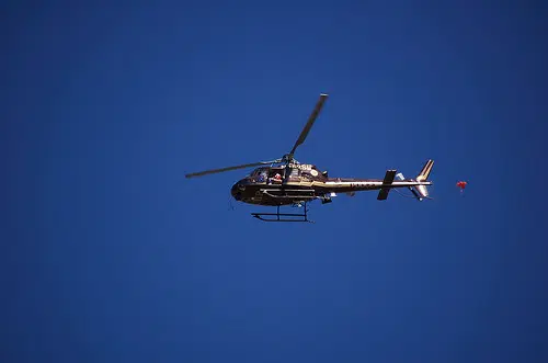
Through a partnership with multiple state and federal agencies, the Wisconsin Department of Agriculture, Trade and Consumer Protection (DATCP) will use airborne electromagnetic (AEM) technology to measure the depth to bedrock in areas of northeastern Wisconsin.
A low-flying helicopter will tow a magnetic sensor that will provide accurate science-based data about below ground properties to update depth to bedrock maps.
Knowing how deep the soil is before reaching bedrock is key to understanding how to protect groundwater from potential pollutants applied on the surface.
Depending on weather and flight conditions, DATCP anticipates surveying to begin in early January, with the helicopter flying over Brown, Calumet, Door, Fond du Lac, Kewaunee, Manitowoc, and Sheboygan Counties.
To learn more about this project, visit AEMSurvey.wi.gov.
")


")


